This is a little photodiary of our recent attempt to summit Mt Whitney. For those of you who dont know, Mt whitney is the tallest peak in the continental US, and its apparently growing as plates under it slowly push it up. If you want to see the slideshow (which has more pictures), its located at
http://picasaweb.google.com/achakra/MtWhitneyAnyway, to start off the story, Jeff and I have been contemplating climbing Whitney for some time now, all the way back in the day when we were living out in California. (Btw Jeff's recount of this trip is
here.) I gave him a call early this year, and said, hey, I gotta go for a friend's wedding in LA in July, why dont we chain a Whitney expedition onto it, so he said sure, let's go for it. Ive climbed HalfDome a bunch of times (a popular hike in Yosemite). Ive never had trouble, but I will admit that at the top of the hike, you're sucking wind pretty hard. Halfdome ends at around 8500ft over 8.5 miles of hiking I think. The hike for Whitney starts at 9000 ft, and then climbs for 11 miles to 14.5k ft. So, the intensity is definitely.. well to say the least.. intense.
Of course this is all dependent on getting permits for the trip which are very difficult to get and highly coveted. I applied for them, and lo and behold we got them. I contacted a few people who were interested and Alex and Padraig gave thumbs up.
The plan was fly into Vegas on Jul 4th (my damn buddy changed his wedding date, and now I hae to go out there again at the end of this month). Drive straight to Lone Pine (where the entrance to the Whitney trailheads are). Then we would camp for the night to get used to the altitude. And then early in the morning we would start up. Our permits were for the 5th and 6th, so we would climb , camp, summit, then hike out.
While planning for this trip, Alex collected a few books about Whitney, and we started tossing around the idea of taking some less traveled routes. One was the Mountaineer's Route (MR). Look it up, u can see that parts of it are pretty damn scary (
http://www.mountphoto.com/whitney/pages/Image9.html).
While the MR didn't require technical climbing (equipment) we weren't quite sure if we could do it. We contacted a guy by the name of Bob Rockwell who was kind enough to give us some advice. This guy is an animal, he's climbed MR 30 times, and we more or less decided this may be a bit too difficult for us.
The day b4 we departed , I called to confirm our permits. Now, when I called the ranger said that my permit was for Jun 5th/6th, not Jul 5th/6th. It was one of those moments where you have been ignoring the obvious for months because you've got it set in your head the dates that you want, and what u want to see. Anyway, I felt terrible, I had to contact the boys, let them know what the drill was, and we started scrambling for alternate options, but we weren't going to stop the trip.
Alex found another route (Meysan Lake). Basically this route is a fairly straightforward 5 mile climb to Meysan Lake. Then you climb a very steep slope (1mile distance, 2000 ft elevation climb, yes close to 40% grade). Then you descend a couple thousand feet, climb up again to Trail Crescent (which meets the Main Whitney trail), and then summit. Then we were planning on climbing down via the Main Whitney Trail.
A few caveats here,, 40% grade is very very steep.
From Meysan lake to Trail Crescent is completely uncharged, no trail, no markers, just our own nav skills and gps.
Did i mention its very steep?
The book mentioned that its class 2 (no hands required, only feet), but it is difficult). JEff was confident he could find the route along with the gps, so we decided to go for it.
Anyway, now onto some pictures:
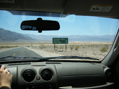
They aren't screwing around when they name places in Death Valley.
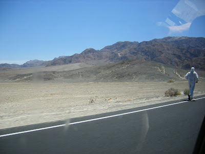
Crazy guy actually running in 130+ heat
When we got to the Ranger station, we were able to land the exact permits that we wanted. We got permits to go up into the backcountry after MEysan Lake, and rejoin the Main Whitney Trail to descent out of. Thank goodness that we got this, I think the other guys may have killed me if we didn't. Just kidding, they were actually be good sports given my collosol screw up.
Also, we asked the Ranger (Ranger Dave) about Meysan lake, he kinda looked at us, and said oh yeah i did that once.
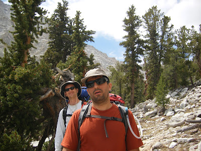
We got to the trail head and quickly starting organizing our packs. The idea was to hike up as far as Possible to Meysan Lake, and then the next morning hit the steepest part fo the climb. This would help us acclimate to the altitude better also. Rather than sleeping at the trailhead (around 9000 ft), we could sleep at the Lake, closer to 11000 ft I think.
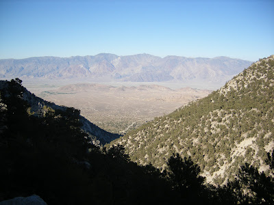
You can see a little tiny road in the background, that's the road from Lone Pine up into Inyo National Forest where Whitney is located. This is around 5pm I think. as you can see the sun has started its daily descent.
After a while, the sun set (around 8.30pm I think), and it was pretty close to pitch black. the moon didn't come out until around 11.30, so we had to get out our headlamps.
We trudged forward with all kinds of crazy flies, gnats, mosquitos being attracted to our lamps. When we came back down two days later, I couldn't believe some of the stuff we did in complete darkness.
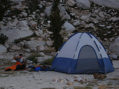
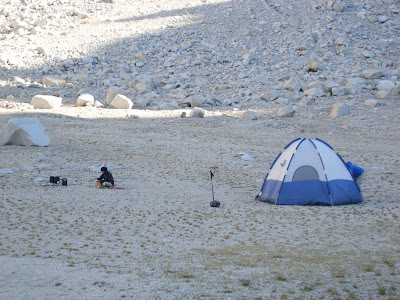
We found a small lake (i.e. we desparately needed water), and we set up camp. We were exhausted as going from sea level that morning (I.e. New York City) all the way to 10000+ ft was pretty hard on the body.
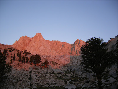
Here's a picture from our campsite.
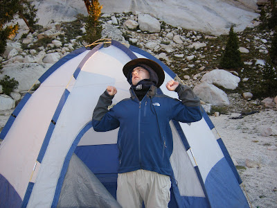
The Irish bear rowrs!
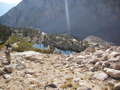
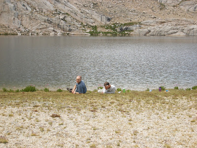
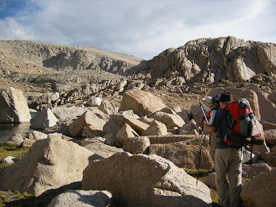
After packing up camp, we basically started climbing for Meysan Lake (close to a mile away). This is a view from the trail above the lake that we camped at the previous night.
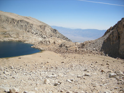
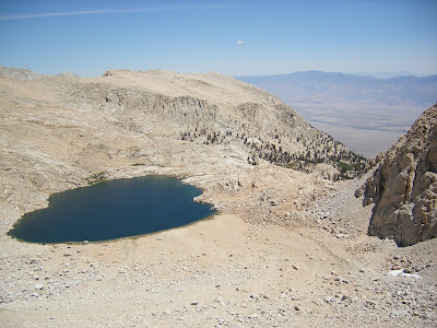
Finally we arrive at Meysan Lake. So odd, that this huge lake is in the middle of nowhere, quite circular, and very beautiful.
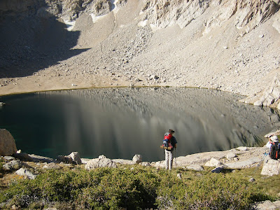
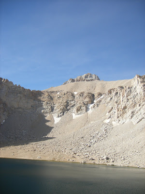
Now I cant quite remember exactly which was which, but the peaks surrounding Meysan Lake are all 14000+ ft tall. Basically the trail ends here, and you have to find a way out of this little valley. So, at this point we saw what the 'steep' trail the book was referring to.Yes, that's what we were going to try to climb.
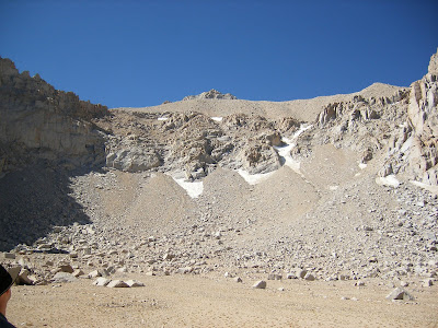
The route of attack was to go between those two pointy patches of snow in the middle of the picture. Just to give you an idea of scale, this climb is really steep and rocky. Those 'small' rocks in the foreground were practically the sizes of small cabins. Just to walk from the point where this pic was taken up to base of the 'hill' took about 10-12 mins. And climbing the rocks from the base to the bottom of the snow took close to 45 minutes. The going was very very slow, basicaly just about every rock was loose, so u had to be excessively careful where you were stepping, and more often than not, the rocks were slipping out from under us so you'd have to be quick to jump to another rock.
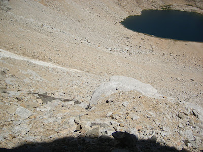
Above is a look down what we climbed up.
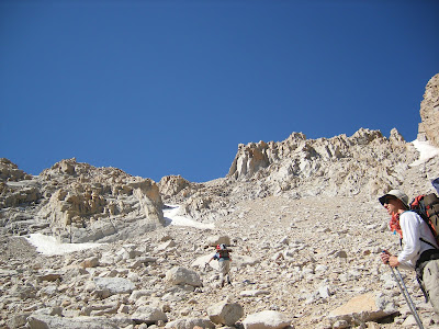
Above, yes its very very steep, and this wasn't even the difficult part yet.
This is the part of the trip where none of us took pictures, but I can describe it as it will be unforgettable (and not in a good way :-) ). At this point, we had made it up to the snow I pointed out earlier. Then the going got REALLY steep. And mind you b4, we were climbing up loose rocks. At this point however, we were actually climbing up the equivalent of gravel (on a steep hill, u do the math..). In addition to that, just about every rock we tried to place our feet on wasn't steady and was loose. We quickly learned that one person couldn't be below another person cuz rocks kept on getting dislodged from where we were standing and flying down the mountain. ITs odd, you know that scene in all the movies where one rock falls, and bounces, falls further, bounces, falls further bounces etc etc, until you can barely hear it. Well that's how it is in real life also. In addition we noticed that just about all of the exposed areas of the mountain were cracking off when we grabbed onto them. Which is unfortunately, because this was DEFINITELY not class 2 climbing(stupid book). This was class 3, we were scrambling and clutching onto rocks with our hands all over the place. Finding good footholds and handholds was getting more and more difficult.
After about 35 mins of this, we rested for a second as we couldn't clearly see which way to go. Jeff being the natural climber of the crew took of his pack and went up a bit to see where we were. He came back with pretty grim news. We weren't even halfway up our 1000 ft climb. It looked really really bad, and we had a long way to go. At this point, we noticed some dark clouds coming in. This may not sound like a big deal, but dark clouds means a few things. This time of year it means lightning typically. The high sierras get struck by more lightning than just about anywhere in the US. We were basically sitting ducks. Not to mention lightning can knock off huge boulders as well. Secondly if it rained, I can't imagine us going down with slippery water adding to the slippery scree and making our handholds more slippery. Moloney and I didn't think twice, we both said, let's head down, no way we can make it further. Now, going downhill on a crumbling mountain SUX. Every step, all the screen beneath turns into a little rock slide which you literally surf down. At this point, Moloney took a bad step, the ground gave way, and he was sliding down the mountain on his stomach clutching at the sliding ground around him to stop himself from going over the edge (not too far away). He stopped himself, as the rest of us watched all the gravel/rocks fly over the edge of the lip below us. At this point, Moloney froze up a little bit, and asked Jeff for help in getting him down. In all honesty (not to sound overly dramatic), but I think if Jeff wasn't so confident and positive, I would have 100% frozen. This was probably the 2nd time in my life that I thought I maybe could actually not make it because we still had to climb down this crumbling mountain (First time was encountering rattle snakes in the Grand Canyon in the pitch black of nightfall). And going down is much harder than going up, especially with extremely unsure footing.
I have to point out at this point, we all slowly starting making it down. And Jeff carried not only his pack (prob around 35lbs), but also Moloney's pack . He was also climbing down without the aid of his poles since he was helping carrying Moloney's pack. Somehow he was able to make it down just fine without falling once (I fell a bunch of times, bloodied up my elbow, palms, and legs, Moloney had his own falls near the top, ruined a good pair of REI pants). Even when Alex, Moloney, and I were slowly coming down near the top of the mountain, somehow Jeff was able to kind of traipse around like he was walking on flat land at sea level,, pretty amazing balance and instincts.
Alex took off cuz he really had to use the bathroom (somehow he had to go 4 times in one day, I think we're going to blame the fact that he was using the iodine water the most out of the lot of us cuz the rest of us were drinking alot of filtered water).. Ok, btw this part is fairly gross. due to the overwhelming number of people that go to Whitney now, you have to pack out ALL of your waste.. Yes that's right, you poo into a bag, seal it, and strap it onto your pack. And, it doesn't seem that any amount of bagging prevented that odor from coming out of that bag. Yes, not a fond memory for sure.
At this point, Jeff started getting really bad headaches (go figure, he carried down two packs at 12000 ft of elevation and also ran out of water). Everyone totally passed out for a couple of hours, and then we started prepping for dinner. We weren't going to be able to summit, but we felt pretty good about the fact that we even got up as far as we did with our skillset.
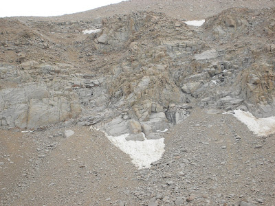
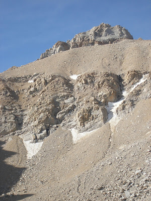
Above. Remember, those snow patches are around 200 ft long. if you look at this dark spot just to the upper right of the left snow patch, that was our entry into the upper part of the mountain.
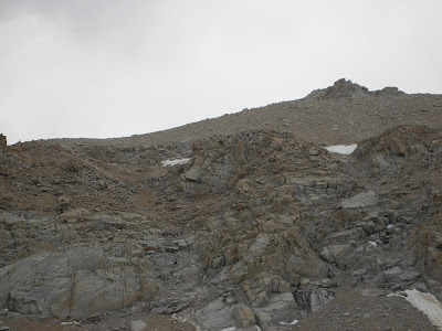
Above. These were the rocks where we got stuck, not fun.
Above. Our camp at the bottom of the mountain, next to Meysan Lake. Some how this shot reminded me of something from Tatooine.
We started our hike back (Above).
Above. One last shot of the lake and our failed attempt to summit to the LeConte/Mallory pass.
Alex not looking too thrilled ..
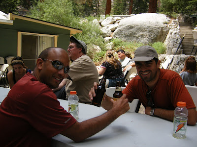
a VERY very welcome beer right after getting to our car and heading up to the Whitney portal store. Btw, they do make a mean burger, very friendly staff also.
I have to mention one more thing, when we went back to the ranger station to drop off our bear canisters (not fun to carry around as they are heavy as hell) we were talking about our failed hike to the ranger there. Ranger Dave wasn't around, but we told them that he said he did this and didn't seem to indicate to us that it was difficult. Well our ranger told us that Dave isn't a normal ranger, no no, he's a 'hiking ranger'. Go figure, that info would have been nice when we first met him :-).
One final note about the climb.. when I got back home, I actually emailed Bob Rockwell again (the experienced moutaineer), and asked him what he thought about this route vs the MR. He said that he's never done this route in non winter weather (oddly enough, when there is snow on the ground its actually much easier to hike up with crampons and ice picks cuz there's less chance to slip on loose rocks). And to top it off, he very quickly emphasized that this hike is WAY harder than MR. So next year, MR here we come :-).
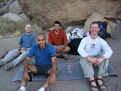
After this, we actually met up with Anne (Moloney's girlfriend) and her family. Her family is VERY big into camping , they have this sweet Hummer (H1, not one of the wussy H2 or H3 for the urban yuppie). They basically go around the country , tour different spots, and camp out of their Hummer. But they do it in style, proper meals etc. So Anne's family treated us to a meal of Indonesian style lamb curry with herb pasta. My lord it was very very good, I think we all had 3 helpings of it. Sure beats the freeze dried food we had been dealing with thus far. A big thanks again to Anne's mother.
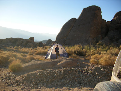
We were actually camping in an area under the Bureau of Land Management. The area is right off the road that leads up to the Whitney trailhead, and is in fact called Movie road (I think). Apparently a bunch of old westerns used to be shot here given its proximity to LA. Being on federal land, apparently its legal to shoot guns here, so Jeff had brought alone his Beretta (I think? I know very little about guns). I should have taken some pictures, but I forgot. But we went out to the middle of nowhere and shot a few rounds at some targets, first time I ever shot a gun, it was definitely interesting.
Triumphant at the end of our hike :-)
Our camp in the early morning, it was already getting very very hot.
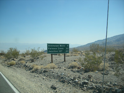
Above. I really like this picture, stovepipe wells and furnace creek, like I said , they dont screw around describing the temps in Death Valley.
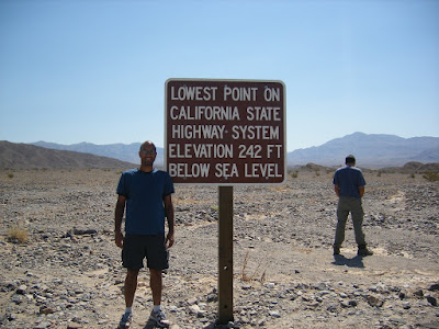
Nuff said.
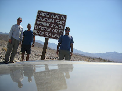
Yes, Alex peeing in the background heh heh.
After this we headed into Vegas. Alex was worried that we wouldn't be able to check into the Venetian as we hadn't showered for almost 4 days at this point. Literally everywhere we stood in the hotel, people would first smell themselves and then look around wondering where that odor was coming from. I think we each had to take 2-3 showers (the motions, not getting in and out) to get completely clean. Im not positive I was clean even after the first two even.
And of course the following day we flew back.